City Council unanimously votes to accept Lake Springfield Plan
Following months of economic impact analysis, hydrological and water-quality assessments and a robust community visioning and outreach process, Springfield City Council accepted a plan for the reimagining of Lake Springfield and James River Power Station property.
The plan sets forth a vision for a redevelopment opportunity very unique to the Springfield area. No funding is appropriated for the project at the current time and acceptance of the Lake Springfield Plan by the Board of Public Utilities and City Council does not imply the approval of any specific section or use that is outlined. Several additional phases will be required to explore funding alternatives, partner collaboration, and strategic planning using the Lake Springfield Plan to assist in determining the best uses of the property for the community.
Lake Springfield was identified as a redevelopment opportunity area during the City’s Forward SGF comprehensive planning process. With the plan, which was funded through an $800,000 grant from the U.S. Department of Commerce’s Economic Development Administration (EDA), a donation from the Hatch Foundation and contributions from the City and CU, the entities hope to spark the interest of private developers.
“We saw this feasibility study as the beginning of an exciting new initiative, with great potential to increase our community’s engagement with the inherent attributes of the Ozarks. We believe this can lead to a project to directly enhance our quality of life through interaction with the outdoors, and were thankful for the opportunity to be a partner,” said Erin Danastasio, Executive Director of the Hatch Foundation.
The project builds upon the regional planning efforts led by the Southwest Missouri Council of Governments (SMCOG) and brought together the public and private sectors to create an economic development roadmap to strengthen the regional economy, support private capital investment and create jobs.
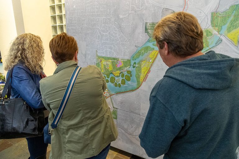
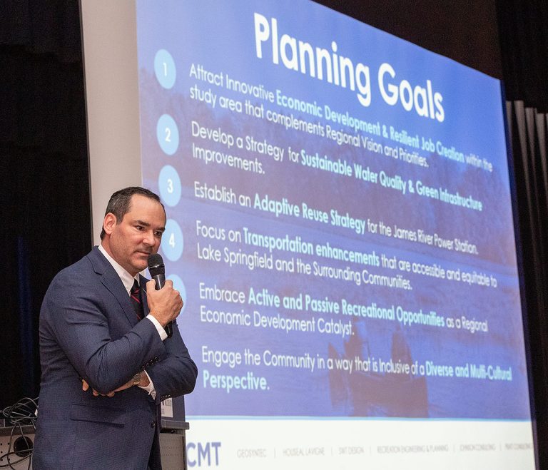
Crawford, Murphy & Tilley (CMT), City of Springfield and City Utilities presented innovative possibilities at a community open house last fall, to City Council at a workshop streamed live to the community, the City Utilities Board in March and finally to City Council Monday evening. This followed more than a year’s worth of public engagement activities that included online surveys, focus groups with neighbors, numerous public open houses and tours of the power plant site and dozens of discussions with various stakeholder groups with different perspectives.
KEY IDEAS:
Dredging sediment to build wetland ecology “islands” connected by boardwalks
Steve Prange with project manager Crawford, Murphy & Tilly, explained the components at a communitywide open house in October, followed by presentations to the City Utilities Board and City Council.
The depth of the lake (less than four feet deep in certain areas due to sediments deposits) coupled with few access points to the water, especially those with disabilities, were identified as impediments to recreation at Lake Springfield during the public engagement phase. Prange said employing a specialized dredging technique to scrape the accumulated sediment into wetland ecology ‘islands’ connected by boardwalks would address these impediments while providing unique recreation opportunities.
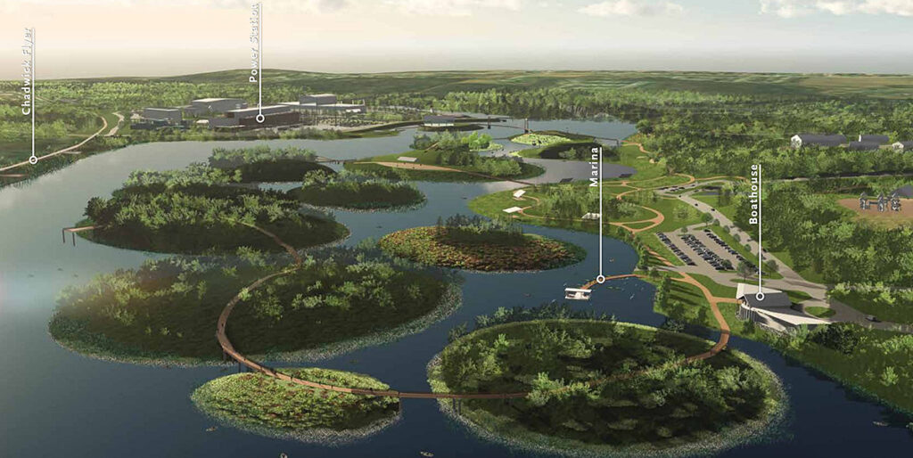
“The eco island concept would be a huge water quality benefit for the whole area,” Prange said. “It would be an awesome enhancement while also maintaining the integrity of the lake.”
Connection to Chadwick Flyer Trail
A pedestrian bridge connecting the park to Ozark Greenways’ new Chadwick Flyer Trail is another proposed component of the plan. The 12-mile Chadwick Flyer Trail is estimated to be complete in the next five to 10 years and will connect Springfield and Ozark.
Possibilities for former power plant site
The former power plant site, decommissioned in 2021, has a couple of potential uses, Prange said. The first is to use the site as an entertainment district with restaurants, retail/office space and housing with riverfront recreation opportunities. A second concept would reuse the site as a water adventure facility that includes restaurants and conference space.
The area southeast of the former power plant site could become a “glamping” zone with cabins, campsites, RV parking and a mountain bike/adventure park.
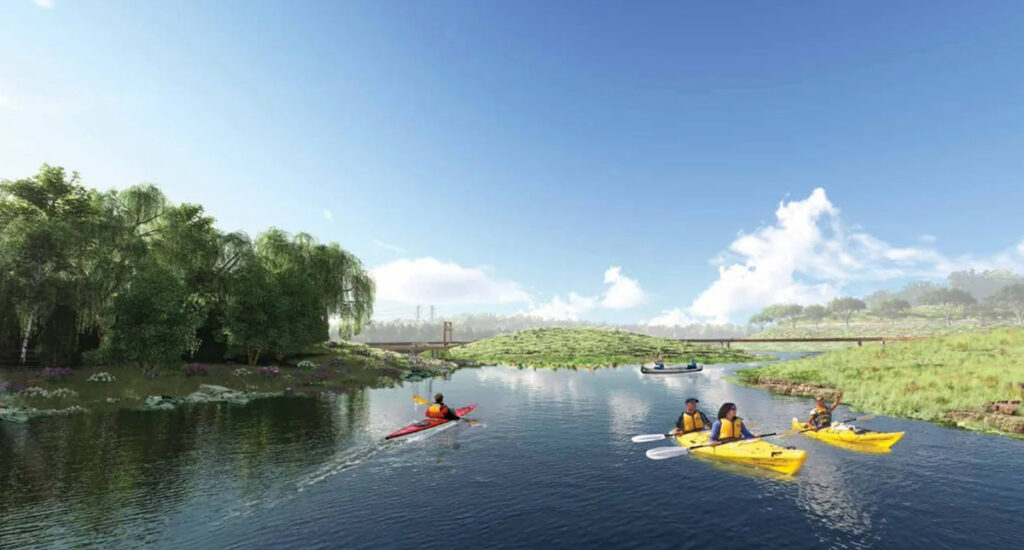
Bypassing the dam
Connecting the lake to the James River via a bypass could lengthen the James River Water Trail and create additional opportunities downriver, he said.
“This is more about embracing who we are in the Ozarks and attracting not only an amenity for our locals to enjoy but to attract other people to come to our community and spend some time, spend their money and really enjoy who we are and what we treasure,” Prange said.
City Manager Jason Gage described the planning process as essential to potential redevelopment and as a catalyst for future activity that helps fulfill the community’s goals of Forward SGF, the community comprehensive plan.
“We were very fortunate to receive the planning grant from the EDA, who had faith in us to think big and cast a vision that will surely become a transformative project in our community. The area has a lot of potential for new amenities for future generations, leveraging the beautiful asset of Lake Springfield and its surrounding nature,” Gage said.
The Lake Springfield Plan is available online at the Lake Springfield Plan website.
For more information, contact Cora Scott, Director of Public Information & Civic Engagement for the City of Springfield at 417-380-3352 or [email protected] or Joel Alexander, City Utilities Media Manager at 417-575-7341 or [email protected].
The EDA grant was made possible by the American Rescue Plan and EDA’s $300 million Coal Communities Commitment. It was the first competitive American Rescue Plan grant to be awarded in the region.